


Assessing revenue from above ... and more.
The Board of Revision of Taxes is using new technology to assess property as part of their Full Value Project.
Published on February 9, 2007 in the Philadelphia Business Journal.
The picture on Barry Mescolotto's computer screen could bring money to Philadelphia's tax base.
The digital image shows vacant land next to tax-exempt railroad property in the Olney section of Philadelphia. The large parcel has historically been labeled railroad property but the land is removed from the tracks, closer to a large building on 3rd Street.
"There is a question of whether that is taxable property," said Mescolotto, a property assessment administrator for the city's Board of Revision of Taxes.
At a modest market value estimate of $50,000 for the 16,825-square foot parcel, Mescolotto said that taxes would bring $1,322 into the city's coffers.
"That's $1,322 in taxes that we could find just like that," he said.
Pictometry International's imaging system and software, which provided Mescolotto the image - and the city that potential income, has been in use here since 2003 and the results, Mescolotto said, far outweigh the price that the city pays for it's services.
It costs the city $80,000 annually to license Pictometry's images and software, with the price being divided among eight city departments: the Board of Revision of Taxes, License and Inspections, the Mayor's office of information systems, the Streets department, the Philadelphia Industrial Development Corporation, the Water Revenue Bureau, the planning department and the Philadelphia Police department.
The BRT pays $10,000.
"It's probably some of the best money we've ever spent," Mescolotto said. "We made the $10,000 back in the first week we had it."
Exact figures have not been calculated but the imaging system has helped Mescolotto's staff of 75 assessment evaluators locate thousands of dollars worth of property tax. And it is revenue that most likely wouldn't have been found using traditional means.
"It takes us places where our guys can't go," Mescolotto said.
Pictometry's thousands of images are generated once per year in an airplane flying a grid pattern over the city four times, in different directions each time. The plane shoots each of the 575,000 residential, commercial, institutional and tax-exempt parcels from the north, south, east and western angles.
The latest set of images - more than 37,000 pictures - were created at the end of 2006 and will be placed into the system this month.
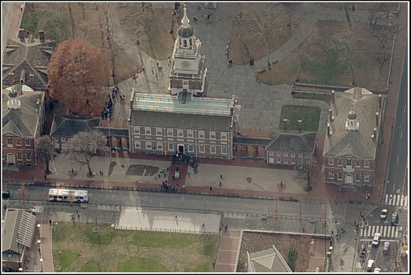
Where satellite imaging and ortho photography show the world only from directly overhead, making everything appear flat, the Pictometry system shows the world at an oblique angle, providing perspective. And they include an overhead shot.
A minimum of 5 images are created for every property, with some parcels appearing in 20 different pictures. At the click of an icon, you can scroll through the various views of any property in the city, which are found simply by punching an address into the system.
Images are accurate to 1/100 inch and evaluators can measure lot lines within the system.
"I can get the full square footage without ever leaving my desk," Mescolotto said. "We can easily find additional tax revenue."
Prior to having the system in place, some properties were too hidden by fences or too insulated by other properties for evaluators to reach. Billboards and power substations were especially difficult to properly assess. If they could get to them at all, evaluators would often have to walk through yards, sometimes past snarling dogs.
"A lot of these giant structures are in very difficult places to get to," Mescolotto said. "This keeps the government out of your backyard."
A Rochester, NY-based private company, Pictometry International uses technology developed at the Rochester Institute of Technology. They have 120 employees and they contract planes and service around the world. Their system is in use in New York, Los Angeles, France, Germany and England. They are in negotiations with areas of Canada, Japan and Australia. They already cover all of Italy.
"We do all the R&D ourselves, which really gives us the leg up on everyone," said Dante Pennacchia, Pictometry's chief marketing officer. "If you can manage your own software, find out what the customer needs and create the solution to it, you're always going to be in great shape."
Pennacchia said that clients use the system for everything from law enforcement and rescue service to city planning and engineering.
An employee in Philadelphia's Public Property division first learned of Pictometry and presented the idea to city officials. The software is now available to any city worker.
"Before we had Pictometry, we were never able to see buildings at an angle - or four angles - plus measure height and distance on a computer," said Brian Ivey, manager of Philadelphia's Geographic information Systems.
The Health Department uses the system to determine where violations originate. The police provide Pictometry images to the District Attorney's office for court cases. About 20 different police units - from SWAT to the Narcotics Division - regularly take advantage of the software. City planners use the system for a multitude of tasks.
"It's another tool for us to do spatial analysis," said Ivey.
BRT staffers are currently using the system to find home additions, central air units, altered lot lines, in-ground pools and various other property changes that have been overlooked, lost in records or built without proper documentation. Those alterations could add value to the property, and thus change the taxes.
The BRT is in the midst of reassessing every property in the city as part of their Full Value Project, which aims to establish the full market value of every property by 2008. The reassessment has been controversial as some reassessments are likely to bring steep tax increases.
"This is one of the tools that we can use to say that we have an accurate, full assessment of each property," said Mescolotto, who has been with the BRT for 33 years.
Mescolotto is negotiating a pilot testing of Pictometry's new "ChangeFindr" software. In a matter of hours, the new software will automatically analyze every property for changes from year to year and then create a list of possible suspects.
"Assessment has had difficulty staying up with the growth, the changes," Pennacchia said. "The return on investment [with "ChangeFindr"] appears to be phenomenal for them."
Mescolotto pulled up another image of two cell phone towers near Woodhaven Road in Northeast Philadelphia. Four separate antennas are visible on one tower, and two on the other. Each tower had only one antenna in the previous year's photograph, and each new antenna is assessed with a market valued around $100,000.
"That's $400,000 right there," Mescolotto said.
And that equates to more than $10,000 in taxes from one image. Mescolotto said that scenario has played out dozens of times in the three years since Pictometry has been used. Numerous antennas have been found all around the city.
"It's like having the world at your fingertips," he said, and then scrolled through a few more images. "Pretty neat, huh?"